GPS HIKES & MAPS: Trip Search Products Using GPS

Thursday, May 31, 2007

Last Week in the Cibola

A recap of Team 5's trip to the Cibola National Forest, thanks to team member Mary Twenter:

New Mexico Team 5 thought of a few clever team names... the "Mojitos" or "Will Hike For El Bruno's Food," but in the end, we really ended up as the New Mexico Five, a team that worked together.

Team 5, pictured left to right: Pat Kinney, Mark Watson, Kurt Johnson, Frank Twenter, Mary Twenter

Our trip was well supported by local trail fans and began at, where else, El Bruno's pouring over maps and enjoying dinner with Dr. Dick Kozoll and his wife who have been working diligently with a local trail team on maintaining and improving the trail in the Cuba area. Dr. Kozoll pointed out several places where we would find the trail to deviate from the maps we were provided and assured us the stretch under their care was well marked.

The first day out began on a slippery slope of Mesa Chivato in the Cibola National Forest. Abundant rain made the road to the trailhead impassable so we had to HIKE... Our stretch of the trail would take us basically up and over four mesas in 55 miles or so.
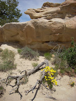
What we saw on the mesa tops was a diverse and beautiful high desert landscape. Mesa Chivato was dotted with pinon and grasslands where we spotted an elk. San Luis Mesa was mostly sand and scrub and La Ventana Mesa was a sandstone dome that provided solid rock underfoot.
Experiencing the environments up close drove home how important it is to get out and learn from the great outdoors - all these mesas look the same from the car!

Our local shuttle driver, Bill Leverton, is the publisher of the Cuba Area Visitor Guide and described the Cuba landscape as, "an area of grasslands, deep, deep washes, high mesas, fantastical rock and sandstone formations and battalions of geologic weirdness" in his December 2006 edition. We agree!

Fortunately, the trail on our section was wonderfully marked with cairns and posts almost 100 percent of the way. We were able to enjoy the scenery because of the awesome work of CDT trail-tenders.

One item of importance for teams to follow: logon to the CDT blogs of regular and thru-hikers to check on issues arising on your section of the trail. We had a wonderful contact from BLM who gave us great tips on our section and knew the trail well but was unaware that a water spigot we were counting on was not operational. He thought it was. Thru-hikers we met knew it wasn't and had planned accordingly. We hadn't.

Thank goodness Dr. Kozoll makes trail calls and delivered water to our camp. Water is the chief concern on this section. The springs we used on either side of the spigot were good sources and well spaced along the trail.

-Mary Twenter

Team Update: Day 4/5

Team 1 is back in touch. The reason for the silence? They were busy. Yesterday the group made the call to push on and finish the section, reaching the final trailhead at around midnight last night. This morning's podcast includes a bit on the latest stretch of trail (they diligently counted 369 downed trees in one 6-mile stretch) and some closing thoughts from team members.

The Latest from the Field

Roger reported in for the Gila Monsters yesterday, having found a bar of cell reception in the wilds of New Mexico. From the sound of things the team is having an excellent trip, and although some planned-for water sources are dry, others are bubbling up unexpected. On Tuesday they put in 16.6 miles, pushing on another 12.1 yesterday to Wagon Tongue Mountain.


Team 3 UTM coordinates: 12S 0735222E 3750180N

No word from Ken and Co., although having a satellite phone along doesn't always guarantee steady communication. Reception can be patchy (it was a little shaky while I was testing it from sunny Boulder, CO), and batteries can run dry in a hurry. Check back for updates later today...

Wednesday, May 30, 2007

Techy Questions

That last post generated a few good questions that require some links, so here's an answer or two:

Q: People have made reference to listening to the phone call-ins, how do we get to do that?
A: There should be an audio control panel graphic (from Gabcast) visible with each post. It requires Adobe Flash Player, which is an easy and free download if not already installed. That may take care of the problem.

Q: How do we convert UTM coordinates to Latitude/Longitude?
A: Well, there's a long answer and a short one. The long version employs any number of complicated equations, involving exciting computations such as Meridional Arcs, footprint latitudes and plain algebra. If you're curious, check out Steven Dutch's explanation (he's a professor of natural and applied sciences at the University of Wisconsin).

The better answer is an online calculator. Just plug in the coordinates and zone, and click away to get your answer (select NAD 83 as your datum...WGS 84 was adopted from it as a world standard). The map on the site doesn't seem to be accurate, but the converted coordinates are spot on.

Tuesday, May 29, 2007

Team Update: Day 3

Today, the team took on the name "For the Best of Times; For the Worst of Times," apparently experiencing a bit of both before finishing the day ahead of schedule in Reeds Meadow. The latter includes a five-mile obstacle course of blowdowns in a burn area; the former includes a firetower lookout from Reeds Peak, an encounter with three other hikers, and a 15-acre meadow that elk and wild turkey call home.

UTM coordinates: 13S 0234046E 3674396N

Word from the Gila Monsters

Team 3, the team out this week hiking sans satellite phone, met up with ranger David Popelka today and is ahead of schedule. David, a trails & recreation manager with the Glenwood Ranger District, says the group has recently finished a section of old service road hiking and is moving on to a more scenic trail system.

David offered help but admits they are well prepared, with water caches set and ready along the route. Area rangers will still be checking in on the team throughout the week, so we may get more word on their progress in the coming days.

Monday, May 28, 2007

Team Update: Day 2

Ken passes the phone around for introductions from the team currently known as "Team 9L-60" (9 liters of water carried in 60-pound packs). The four hiked 9 miles today, gaining elevation as the pine forest broke into an aspen-fir mix. They're currently camped near Aspen Spring, not far from Reeds Peak, the tallest in the Black Range at 10,011 ft.

UTM coordinates:
13S 0228232E 3667516N

Sunday, May 27, 2007

Team Update: Day 1

The team has reunited at the Rocky Point trailhead after splitting breifly to knock out the first 13.5-mile leg of trail. The terrain was rocky, though well-marked, and the wilderness was true to it's name--the team didn't encounter another soul all day. "If you want to get away from it all, this is the place to come," says Ken.

UTM coordinates: 12S 0779273E 3668611N

Team Update: Day 1

Ken reports in after lunch, following an 8-mile morning from Rocky Canyon, heading north to the Rocky Point trailhead. Due to initial concerns about water, the team has broken out this intial 13-mile stretch as a day hike, set to rendezvous with Matt at the trailhead tonight, where a car (and water) awaits.

UTM coordinates: 12S 0775514E 3665750N

Saturday, May 26, 2007

Team Update: Pre-Trip Planning

All of Team 1 has met up after a long day on the road (that's Ken, Steve, Matt and Jason--Natalie couldn't make the trip in the end), and reports in from their pine-forest camp under a clear, moonlit sky.

UTM coordinates: (WGS 84) 12S 0769462E 365*966N

Friday, May 25, 2007

One In, Two Out

Yesterday, Team 5 pulled safely off the trail into Cuba. From team leader Pat Kinney's initial reports it was a fine time, and everything went smoothly. The only potential stumbling block came when a supposed water source turned up dry; luckily, one team member had a bar of cell reception and called in to Dr. Dick Kozoll, a Cuba local and trail advocate who often volunteers for the CDTA. The good doctor was kind enough to drive down and place an emergency water cache for the team, saving them an uncomfortably dry stretch of hiking. Dr. Kozoll has offered to assist other teams hiking in the area, so watch the blog for an upcoming, more proper introduction.

This weekend two more groups are out, Team 1 and Team 3 (aka The Gila Monsters). Both teams are heading to the Gila National Forest--the Gila Monsters will be joined by area rangers on their hike as they cover 65 miles from the Coyote Peak stock tank to Mangas Mountain.

Team 1 will strike out into the remote Aldo Leopold Wilderness, originally designated in 1924 as a part of the Gila Wilderness (the two areas were split when an administrative road was built in 1931). The complex was the first to be protected simply because of its sheer wildness, which Aldo Leopold recognized as a young ranger in 1909.

The team covering the wilderness will carry an Iridium 9505a satellite phone, so their journey will be logged here via podcasts. The phone is actually a little lighter than the Globalstar we sent with Team Southern Terminus, weighing in at 375 grams (0.83 lbs). We should have first word of their trip by Sunday, so once again, stay tuned.

Thursday, May 24, 2007

The Walkumentary Update

Lawton Grinter (aka Disco), an '06 CDT southbounder, has finished editing his documentary on the trip and is shipping to up-and-coming Walkumentary fans everywhere. The DVDs are free of charge, but donations are welcome--keep in mind he not only had to walk some 3,000 miles to get the footage, but also spent more than 200 hours editing it all back at home.

Check out his blog for more information, or read our April 25 post here.

Disco will be hitting the trail again this summer with Team 14, heading down to Colorado's Cumbres Pass on July 30th.

Wednesday, May 23, 2007

Last Week in the Gila

With last week's teams back at home, the next step of the project has begun: organizing the boatloads of data they collected. For example, Dean from Team 4 took a full 327 photos, and there were four others out there with him snapping pictures, taking video and collecting GPS waypoints and track data (Greg handled the latter). There's also the notes to go along with all of that, which Rebecca diligently scribed.

But on to a few of these pictures, soas to put a better face on the Gila National Forest. The first is a good snapshot of a stretch towards the start of the route, looking south along the Black Range. The trail eventually makes a turn to the west, striking out across the storm-swept plains (from Team 4's experience, at least).

As Dean reports, the rain came like clockwork: at 10 a.m. cumulus clouds began to form, giving way to noontime thunderheads and evening rainstorms. The ominous-looking clouds pictured here rolled in on Tuesday, dropping pea-sized hail on the team for some 45 minutes. The five of them piled into a 2-person tent in order to avoid a pelting.

The storm picture below was taken Wednesday, and captures the twisting start of the famed tornado. The team had dealt with a cold, wet night on the San Agustin Plains, and decided to hump it to the tree-cover of Pelona Mountain (0768533E 3729956N, 12S) after spotting another storm rolling in Wednesday afternoon. Greg, Rebecca and Matt had taken the lead, leaving Dean and Eric behind with more gear. Dean remembers the initial back-and-forth after eyeing the twister:

"Is that a tornado over there?"

"I don't think so...I don't think they have tornadoes in New Mexico."

Ah, but they do. In the end the storm was a few miles off and didn't so much as stir up a good gust near the trail. But a tornado in the backcountry, with nary a basement or storm cellar in sight, can be quite unsettling. For Dean, this marked the second he's seen in as many years; last year, an Easter storm spawned a tornado on his property. The twister rearranged some outbuildings and did a number on his house, although it's since been patched up. His take on his most recent sighting?

"It was both scary, and really neat at the same time."

Tuesday, May 22, 2007

The I.C.

This week Team 5 is the only group out, covering a 55-mile stretch south of Cuba, NM. An area near their southern trailhead is known among land managers as "The I.C.," putting the team's exploits in prime running for the next hit show on FOX.

But Orange County the I.C. is not; the initials stand for Ignacio Chavez, a local who was granted land by the Spanish government in 1768 in an attempt to populate the area. As Team 5 will discover, the attempt was a dud. The barren volcanic upland has thin topsoil, is studded with boulders and, in the time of Senor Chavez, was frequented by Navajo raids.

As a result the I.C., now managed by the BLM as a wilderness study area, is rich with wildlife. Elk graze patchy grasslands, and a rainbow of birds nest among ponderosa pines, Douglas fir and pinon pines. The trail leads north along the Rio Puerco, a river that typically carries more of a trickle of silt than a rush of fresh water.

The map posted above will give some idea as to the data teams are working with in the field. The waypoint here marks the southern trailhead of the section, and the track was pieced together by Backpacker map office staff (with assistant map editor Andrew Matranaga leading the effort). That track was cobbled together from a variety of federal resources, and represents the most up to date CDT route as designated by land managers. It sometimes strays from more popular thru-hiker routes, but if you're looking to hike the official National Scenic Trail, this is it.

With that data in hand, teams will hit the ground and see what's actually out there. Sometimes what's on the ground will match the map to a tee; sometimes it may be off by a hundred yards or so. As data that previous teams collected comes in, we'll have a better idea of where the CDNST is actually running these days.

Friday, May 18, 2007

Another Week, More Miles

Word has come in from Team 4; they finished up last night and are taking today to enjoy some much deserved R&R. Lisa, team leader Dean's wife, chatted with him today:

"They finished last night around midnight by putting in a 20 mile day. He was very upbeat and said it was an incredible trip. It stormed every night and one night it was below freezing. They got stuck out on the plains in a hail storm huddling together in a tent for about 45 minutes until the hail stopped. Stated his team 'ROCKS' and everyone worked wonderfully together--a great group of people."

And from team member Greg White's wife, Courtney:

"He said that he had a blast. He said that they got a picture of a tornado and that they also ran into a Pygmy Rattlesnake. They had just checked into the motel and were going to get some much needed rest. After they wake up, they plan on doing some sight seeing."

Nothing like an online, interactive map of the King of Trails PLUS tornado pictures! We're glad to hear everyone had such a great time despite the acts of God. Thanks to the team for their hard work; more from them to come as they return home.

Team 2 is also safely off the lava flows, where the going was tough. Hats off to team members Doug and Bob for their efforts, and a special thanks to team leader David Morganwalp for working out logistics at the front end. The trail runs through tough country, and every mile covered by volunteers is greatly appreciated. The final resource, available to hikers, land managers and trail advocates as a planning tool, will be well worth the effort.

Thursday, May 17, 2007

Thrilla in the Gila

The support for Team 4 is impressive, so I'd say it's about time for an update. In the end, the two teams out this week weren't issued satellite phones, hence the lack of podcasts. And as far as cell coverage goes, it's quite simple, at least according to Gila National Forest Recreation & Trails Manager Les Dufour. Speaking of team leader Dean Rainwater, Les spelled it out:

"If he has a cell phone, he's out of luck."

But it sounds like the weather down there is at least making for a pleasant enough experience. Where water scarcity is usually an issue, the region has recently been buffeted by a string of afternoon showers, predicted to stretch into the weekend. The team's water caches may very well be rain-soaked by the time they find them.

"It rained a full inch here last night," Les said. "They were probably getting to their second stash of water right as it was really coming down on them."

Maybe not the New Mexico experience they had in mind, but so it goes on the divide. Here's hoping they packed that rain gear.

Tuesday, May 15, 2007

The Zuni Acoma Trail

Yesterday, Team 2 hit the lava flows and tackled the ancient Zuni Acoma Trail, a long-cairned trade route between the Acoma and Zuni Pueblos. The terrain wasn't kind. A call to the visitor center turned up team member Doug Melton, preparing for another trip to the flow this morning.

"We did about seven miles of it, and it whupped our ass big time," he said. "It's probably the most inhospitable, rugged hiking I've ever done in my life."

Inhospitable? Rugged? Then why the centuries-old history of use? Maryanna Ireland, park guide and visitor center manager, says it was simply the shortest walk from point A to point B. Most of the original path was paved over when State Route 53 went in; all that remains is what's protected within the El Malpais National Monument.

And the hike can be enjoyable enough, it's just a matter of being prepared (its original walkers were in Yucca sandals, after all). A full day must be set aside for the trek, with plenty of water on hand. Maryanna also recommends hiking it from east to west, making the 700 to 800 year-old cairns easier to spot in the sun. The payoff is a trip to another world, over a relatively fresh gush of once-molten rock.

"It's the youngest lava flow in this area," Maryanna said. "In geologic time, it blew up about 2:00 p.m. yesterday--that's how fresh it is."

Depending on who's doing the dating, yesterday afternoon translates to anywhere from 1,000-3,000 years ago.

Doug and the rest of the team will finish it up today, forgoing Yucca sandals for their lava-chewed boots. Then it's off to smoother hiking along the Chain of Craters, where the trail breaks free of the lava flow and meanders through a series of geologically older cinder cones.

With luck, they'll be the ones doing the whupping from here on out.

Sunday, May 13, 2007

And They're Off!

Two more teams are hitting the trail this week; New Mexico Teams 2 and 4 will be collecting data on roughly 100 miles of trail. Here's a rundown of the sections:

New Mexico 2: Chain of Craters
The team will hike south of Grants, New Mexico, in a 50-mile arch west of NM 117. Chain of Craters, in the El Malpais National Monument, is a playground of ancient lava flows and cinder cones, the remnants of the Rockies' very active geologic past. The area is no stranger to passing travelers: through the centuries Spanish conquistadores, civil war-weary U.S. troops and railroad barons have scoured the land for potential profit. Thanks to a national monument designation, the land won in the end.

New Mexico 4: NM 59 to Coyote Peak Stock Tank
This 58-mile section runs through a part of the Gila National Forest managed by the Black Range Ranger District. Most of the CDT in this area is freshly-established, having been rubbed out by a wildfire in years past. The CDTA's official guidebook describes the stretch as "pretty mellow country," with more rolling hills than jagged peaks, but thin water resources should make for an interesting challenge nonetheless.

Wish them luck! We'll post updates from the team as we hear word on their progress.

Monday, May 7, 2007

The Word is Out

Our trail project is growing legs, to say the least. Event organizers @ the Where 2.0 Conference want us to do a presentation on the CDT Project later this month in San Jose, CA. Gurus from Google, MapQuest, Yahoo Maps, Garmin, and many other location-based companies will get a firsthand look at the segments already mapped by teams, plus a primer for what's to come later this summer.

Kris Wagner, Map Editor

Sunday, May 6, 2007

New Additions

Here it is, May 6th, and still no final word about all of the teams? Well, yes, but for good reason. Last week, as we were spreading the word to 300 prospective volunteers, we realized that there are some great sections of trail out there that need more coverage. Particularly, the San Juans in southern Colorado and the Bridger-Teton Wilderness, just south of Yellowstone. There's also Yellowstone itself and Glacier National Park; spots that deserve just a little bit more attention, where a 35-mile trip can last well into the week.

So we pored over maps and came up with six new sections, meaning six new teams with spots for roughly 30 more volunteers. So the coming week will bring more good news to those wanting to get out on the trail this summer and do some recon. Thanks for your patience--we're anxious to get this thing rolling ourselves.

In the meantime, we are hearing back from loads of volunteers that have signed on, and the range of experience and skill sets are quite impressive. A team that's heading to Montana will be joined by Clay Zimmerman, an outfitter from Utah who manages a unique staff: pack goats. About six breeds of dairy goats make excellent hiking companions over rocky terrain, and Clay straps the bearded porters up with their own packs to help spread the load. You can check out his rental site, High Uinta Pack Goats, for a better look at the hearty hoofers.

Wednesday, May 2, 2007

Dealing with Altitude

I noticed a good comment/question from a Rhode Islander following that last post: "Since we are the Ocean State with a high point of 812 feet, how do we train for 12,000 feet of elevation?"

Many project volunteers will be dealing with similar transitions, jogging to catch a plane at 110 feet one day, slogging up a hill at 11,100 the next. An article ran in a 1999 BACKPACKER that is forever timely, and a good read to boot. The author, Michele Morris, threw herself headlong into a high-altitude hike in the name of science.

Here's a snippet from 11,430 feet:
Midway up what seems an endless switchback, I'm doubled over, gulping the thinning air like a goldfish on carpet. The day started well enough, even though I awoke four or five times during the night. We were on the trail by 8:30 after a decent breakfast, and lunch was a restful repast in a sun-dappled grove of spruce and pine.

But just after lunch, a nagging ache took hold behind my eyes and it has translated to a permanent squint. We're above treeline now and hiking into a buffeting wind so strong that at times we stand in place, unable to make headway against the force...

Not that this defines an average trip to the Rockies, but it's good to be prepared. You can read the full article online for tips on dealing with a big change.

Tuesday, May 1, 2007

We Mapped You!

Here's some fun stats about the applicants, but first, a cool map (courtesy of Assistant Map Editor Andrew Matranga) that displays the applicant pool from the 50 states (click on photo to see a bigger map).


2,976 people applied for the CDT Project. All 50 states were represented, and some states surprised us with their turnout (17 hardy souls in South Dakota!).

California came in as the top dog with 299. Colorado was a close second with 241. At the lower end, Hawaii was the least-represented US state with three applicants.

Even more interesting were the international applicants.

Our neighbor to the north, Canada, brought in 40 (the same number as the State of Maryland). We had some members of the Armed Services stationed overseas who applied--five in Germany, two in Korea, one in Iraq, and one in Afghanistan.

Then, there's the random places where BACKPACKER ends up: like the two people in Bermuda and Brazil (respectively), or the single applicants from New Zealand, Israel, the U.S. Virgin Islands, and England.

We could go on and on... We now know the magazine travels the world.

But, more importantly, thanks again for the creative essays, the unique videos, and the wall calendars. You are the best readers we could ever hope for. We had a blast going through the applications...in fact, we should get back to that!

May 1st

Well, the big day has arrived, and we've started contacting potential volunteers for the mapping project. Getting teams together has been a bit trickier than we'd originally thought, as you may have gathered from previous posts. With that in mind, don't give up hope if you don't hear back today--we'll be sending out good news throughout the week.

We'll let you know when all selections have been made, but rest assured that whatever the case, should you find yourself as a Backpacker volunteer this summer or not, we want to show you how much we appreciate your applying. All of the applications were impressive, and the numbers alone were inspiring; the CDT is in good company.

The CDTA, Backpacker and Trimble are currently compiling a list of freebies to send out to all applicants.