GPS HIKES & MAPS: Trip Search Products Using GPS

Friday, August 31, 2007

Gathering the Pieces

This is an exciting time--and one of the most memorable of my career so far. In the past few weeks, we've seen hundreds of photos from several segments of the Continental Divide Trail. The result of this project is coming alive in front of our eyes as we begin to edit sections, doubleback with land mangers, and, most importantly, assemble all the great stories, field notes, and media everyone has collected. All that talk, all those logistics, all those phone calls and emails were worth it. It's going to take weeks to put it all together, and if you haven't heard from us you will soon.

In the meantime, we'll be posting short reports and an appetizer of photos here, and we'll be catching up on a backlog of emails from team leaders. Just a few hours ago Jonathan Ellinger sent me an email:

"We finished last Saturday our trip from Big Hole Pass to Goldstone. My blog entry for the trip is here." Cool blog Jonathan! You can see photos from the trip on Flickr too.

Wednesday, August 29, 2007

Ernie Pyle Search Party is back

Eli Schelin emailed us a short report this afternoon on their scout of the most northern 50 miles of the CDT.

"We covered the 52 miles from Waterton, Alberta, Canada to the Jackson Glacier Overlook. The trail is in excellent shape and is well signed. We saw lots of wildlife – deer, long horn sheep, and mountain goats in the campsites and on the trail. And we even saw a snow flurry as we came across Piegan Pass on the 8/23. All the team members did a great job supporting one another and sharing their skills and knowledge.

We have a ton of pictures that everyone is sorting through – but in the mean time I’ve attached one picture of the search party at the trailhead in Waterton, Alberta, Canada on the 8/19. From left to right are Andy Hubing, Brian & Shelley TerBush, Robert Vanderhoof, and Eli Schelin."

Hiking Around Montana's Wildfires

Check these photos out! Keith Gebo sent these in today from Team 49 on the CDT in Montana. There fires surround them for most of the trip. "We should have some great shots of a big grizzly bruin. The smoke kept us from getting very many 'Big Sky' photos," say Keith. "There were some serious issues with the trail markers and the trail conditions to a lesser extent. I used a MP3 voice recorder to document the trail conditions and warnings. I am working on transcribing it. When I finish I'll send a copy to you. I will also be sharing the information with the local USFS." Thanks for the update Keith.


Tuesday, August 21, 2007

On the Divide, Not the Trail

Here's a new twist: Over the next two years Glenn Dunmire plans to backpack, scramble, climb, or do whatever it takes to trace the Continental Divide.

Not the trail, but the Divide itself.

His hope is to straddle the entire backbone from Mexico to Canada. Most of it will be off-trail, and some hairball sections will require X-treme climbing skills on rotten rock. Most of the trip he'll do solo, too.

Oh yeah, and according to his website, Glenn is doing this truly epic adventure on a rehabilitated hand with three missing carpal bones and a crippled left knee with "no ACL or medial or lateral meniscus."

Imagine the logistics to work a trip like this out? Imagine the all the T-storms he'll have to face being above treeline most of the time? Good luck, Glenn, we'll be watching.

The rest of the High Boy story...

Since our last blog on the Helena High Boys (Team 48), the team has successfully completed their 42-mile section. Listen to the rest of their adventure unfold below:

AUGUST 15 (DAY 3)
In this two-part podcast on Day 3, team leader Steve Wargo reports a few blisters but overall three great days. Tonight they camp at 7,800 feet under the shadow of Mount Black in grizzly country. They also talked about their encounter with The Onion, the thru-hiker who plans to yo-yo the trail this year.

First Report


Second Report


AUGUST 16 (DAY 4)
"Today has been absolutely spectacular!" The team tagged several peaks today, including the highpoint on their section. GPS location: 12T 0383937E 5183942N.


AUGUST 17 (DAY 5)
The five High Boys arrive back in Helena, MT. Team leader Steve reviews how they mapped some of the tough areas of their section and they have a lot of suggestions for land managers and BACKPACKER. In addition to other highlights and last thoughts about their trip, Steve tells a funny story on how a CDT sign clocked one of the High Boys in the head on their last night.

Team 32: Team Tarpman

Team co-leader and frequent map contributor Leon Nelson of Redding, CA sent in these photos from their 50-mile leg in the Wind River Range of Bridger-Teton National Forest last week. Leon says the elevation proved to be the biggest challenge for the group who all came from hometowns well below 1,000 ft (the trailhead was over 9,000 ft.). Leon plans to call in day-by-day podcast reports later this week to re-cap their adventures. Send us more photos too, Leon!

Thursday, August 16, 2007

Yo-Yoing the CDT

Have you heard of this guy? Garret Christensen (trail name: The Onion) is attempting to yo-yo the CDT this year. That means he'll hike from Mexico to Canada then turn around and hike back to Mexico for a total of roughly 6,200 miles. Team 48 crossed paths with this speedhiker yesterday in Helena National Forest. By 5 p.m., The Onion already had 20 miles under his belt for the day and said he finished his north-bound hike in an impressive 95 days. He was on Day 105 or 106 and heading back to Mexico. So he's hiking about 33 miles a day, plus more miles on re-supply days. You can follow his progress on his blog.

Team AWA (Altitude Without Attitude)

This quick report came in last night from Sean Bullington of Centreville, VA:

"Just wanted to send you a quick update to let you know that we are back from the trip (we got in from Jackson, WY this past Sunday morning). We're sifting through the pics/etc and will be working on the trip report over the next week. Other than some blisters, having longer days than expected, walking through some good storms, seeing tons of wildlife, and having to re-route around a grizzly eating a horse on the trail, the trip went really smoothly! We'll keep you posted as the report gets finished, and here's a pic of us near some thermals on the way to Heart Lake!" Thanks for the great attitude and help, AWA!

Tuesday, August 14, 2007

Team 48: Day 2

From a windy saddle, Steve Wargo hells out a big thanks to David Payne and Michael Brown who helped his team through a parched and unsigned section of the CDT yesterday in Helena National Forest, Montana. The team completed 11 miles yesterday, and plans to hike 8 today. Listen to podcast below.

GPS Location: 12T o399751E, 5174135N

CDT Team 23: Copper Mountain to Bakerville, CO

A quick recap from team member Kim Phillips:

"Our team set out last Sunday, August 5th to map a 67-mile stretch of the Continental Divide Trail in Colorado. After three days of steady rain and drizzle, the clouds lifted just in time for the high-altitude portion of the trip. The remaining three days were spent at 12,000+ feet, navigating exposed ridgelines and gaping at the dramatic Rocky Mountain views. Although the rugged terrain caused a few injuries, our group persevered, summited the final peak of the trip (14,270-ft. Grays Peak), and finished in Bakerville." More photos below:

Monday, August 13, 2007

Skywalkers Report In

This report and photos just came in from Todd Fontaine of Team 20.

"Group 20CO, aka Skywalkers, finished their section of trail on August 4th. Our trip brought us through some parts of the CDT that were currently under construction as well as across the well-established Monarch Crest section. With the help of Mal Sillars (CDT surveyor), who joined us for the first two days, we were able to map approximately 12+ miles of the soon to be CDT. We had decided to go with light packs for there were sections that hadn't been established yet. This meant crossing talus and scree fields as well as navigating our way through sections of brush, but the payoff was amazing. Once we hit the completed trail we were able to really appreciate all the work that goes into trail construction. Our group met up with a couple of crews and their work was truly incredible. The next three days we hucked our heavy packs up and over Chalk Creek Pass, past Hunt Lake and then to Monarch Pass. Due to some time constraints and a desire to beat the hordes of mountain bikers on the Monarch Crest Trail, we dumped our heavy packs and decided to blast out the 11 or so miles with light packs to finish at Marshall Pass."

And They're Off...

Steve Wargo of Team 48 (Helena Highboys) reported in this morning from MacDonald Pass about 14.5 miles west of Helena, MT. Steve, as you might remember, submitted a YouTube application early this spring, so we're expecting lots of exciting coverage from the team. The team was briefed by Montana Wilderness Society this past weekend, and is joined by a local Forest Service expert today. This difficult section will require keen navigation skills. Listen below:


Team AWA (35a)

Naomi Blagdon recaps their adventure on the CDT last week. Their 60-mile section, including a 2-mile reroute to avoid a problematic bear, stringed together Yellowstone National Park and Teton Wilderness. Listen in as she lists all the wildlife and beautiful scenery they saw, plus the unique characters on the trail, including thru-hikers and cowboys.

Tuesday, August 7, 2007

On the Trail

This week we find four more teams on the trail. They are:

Team 23
This trio will hike a 38-mile segment from Copper Mountain to Argentine Pass in White River and Pike National Forests. Here, the CDT follows the Colorado Trail.

Katie Richards
: AT thru-hiker ('05); Student Conservation Association volunteer (Baxter SP trail crew). Lawrenceville, GA.
Kevin Hollebeek
: professional surveyor; AT thru-hiker ('05); frequent trail crew volunteer; Katie's boyfriend. Lawrenceville, GA.
Kim Phillips: Backpacker map intern; CU-Boulder graduate student; wedding photographer. Boulder, CO

Team 26
The Rambling Routers are exploring a 40-mile leg near Rabbit Ears Pass, Steamboat Springs, CO.

Jennifer Salvage: AT thru-hiker ('00); first woman to thru-hike IAT solo; teacher by profession; has run AMC thru-hiking workshops. Medford, NJ.
Myles Hayes
: Professional photographer; previous WFA certification; High Adventure Club president, TCU. Chicago, IL.
Jeff Salvage
: race walking expert (took it to the trail); maintains greattreks.com; Jennifer's husband. Medford, NJ.


Team 43
This small team lost a team member late in the game due to a family medical emergency (hope all is well, Adam) but the duo still plans to trek from Chief Joseph Pass into Salmon National Forest, past Chief Joseph Pass.

Steve Silberberg: Former computer programmer; current wilderness guide (Fatpacking). Hull, MA.
Jason Stevenson: Associate Editor, Backpacker magazine. Emmaus, PA.


Team 50a
The Continental Dream Team is one of the several team displaced by the massive wildfires in Bob Marshall Wilderness Area. We know the team was still planning to meet in Montana, but don't know their final route.

Michael Rutland
: freelance writer, photographer; EMT experience; survival experience. Austin, TX.
Dianne Deering
: LNT State Advocate; passion for the outdoors.Denver, CO.
Miguel Esquivel
: Spearheading creation of Trans-Panamaniam Trail from Colombia to Costa Rica; GPS & navigation instructor; CPR certified. Panama.
Jim Jakicic
: Mini-Cassia Idaho Search & Rescue officer; experienced backpacker. Rupert, ID.

Checking with Team CO24

Team CO24 (Jeremy, Jim and Dylan) reports in from the finish of their 64-mile hike from Herman Gulch to Monarch Lake. They traveled mostly above treeline through the Vasquez and James Peak Wilderness Areas in the Arapaho-Roosevelt National Forest. Listen to their detailed highlights by clicking on the video icon.

Wednesday, August 1, 2007

This Week

Four teams are on the trail this week: 2 in Colorado, 2 in Wyoming. They are:

Team 20
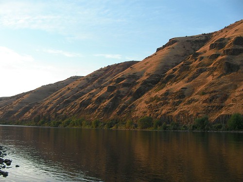
A 55-mile section from Marshall Pass to Cottonwood Pass Road in San Isabel National Forest.

Sally Pfrimmer: Colorado local; amateur photographer; Rocky Mountain wildlife savvy. Canon City, CO
Todd Fontaine
:gradeschool teacher; experienced backpacker.
Michael Morin
: Colorado park ranger; passionate about recreation, nature, hiking. Pine, CO.
Doug Ouren
: Wilderness & winter survival instructor; USGS wildlife ecologist; professional GPS use; wilderness first aid experience; Stephanie's husband & Fletcher's father. Fort Collins, CO
Stephanie Ouren
: Backcountry cook; map reader; Rocky Mountain flora savvy. Fort Collins, CO
Fletcher Ouren
: Doug & Stephanie's 13-year-old son; has taught GPS to elementary students; amateur photographer (digital); experienced backpacker. Fort Collins, CO.


Team 24
Herman Gulch to Monarch Lake
This 64-mile leg travels mostly above treeline in Vasquez and James Peak Wildernesses and Arapaho-Roosevelt National Forest.

Keith Martin: Colorado local; trail crew volunteer; passionate about hiking. Durango, CO.
Dylan Kuhn
: maps trails as a hobby (check out his work at http://www.cyberhobo.net/hobomap/?cat=14&zoom=4). Fort Collins, CO.
Matt Taylor
: GIS director, Clear Creek County, Colo.; map lover; GPS-savvy. Idaho Springs, CO.
Jeremy Larsen
: GIS, GPS, cartography experience; navigation instructor; pursuing graduate degree in geography. Salt Lake City, UT.

Team 34
A 40-mile section from Brooks Lake to Turpin Meadows Campground
Barry Gibson: amateur photographer; aspires to open B&B out West; GPS-savvy. Seven Fields, PA.
Barb Cooey
: Assistant leader, National Sierra Club; backcountry gourmet; certified in LNT, CPR, first aid. Dubuque, IA.
Jeff Carver
: father of six (between him and wife Kathy); often takes the clan hiking, kayaking, scuba diving, mountain biking, running, fishing and camping. Esko, MN.
Patrick Brown
: Backpacker map project contributor; amateur photographer; Bridger-Teton section is on his wish list. Germantown, MD.
Kathy Carver
: First hike with husband Jeff to Tetons; current Duluth Aquarium employee (? - correct me if I'm wrong); avid hiker, biker, etc. (see Jeff's bio). Esko, MN.


Team 35a
(nicknamed Altitude without Attitude)
This team will explore southern Yellowstone National Park to Turpin Meadows.

Sean Bullington
: Mapper for localhikes.com; recently returned from Patagonia backpacking trip; self-proclaimed GPS nerd; husband to Paula. Centreville, VA.

Paula Bullington
: degree in recreation management; experienced backpacker; husband to Sean. Centreville, VA.

Naomi Blagdon
: AT thru-hiker ('03), subsequent fan of good trail data; Lorne's daughter. Toronto, Ontario, Canada.

Lorne Blagdon
: AT thru-hiker ('03) ...pulled off a 40-mile day from Harpers Ferry to Mason-Dixon line; trained in search and rescue, orineteering by Canadian Air Force; writer, song writer. Wirral, New Brunswick, Canada.

In The Texas News

The Daily News in Galvenston, TX recently published a story about the CDT Project and local Steve Smith, a member of Team 15b. Read the STORY by Mark Collett.